
3D Laser scanning services & As-Buit Surveys
We rebuild the geometry of elements and infrastructures using 3D laser scanner technology
Our laser scanning services
We are a specialized company offering comprehensive 3D digitalization and measurement services utilizing laser scanners. Our expertise lies in the meticulous collection, analysis, presentation, and delivery of geospatial information. We excel in high-definition geometric capture and documentation, ensuring a detailed reconstruction of landscapes, objects, and infrastructures.
Our services are highly valuable for a diverse clientele, including architects, engineers, BIM developers, government institutions, companies, scientists, and artists. We empower these professionals and entities with accurate and detailed 3D representations, supporting their projects and enabling informed decision-making in their respective domains.
Our job
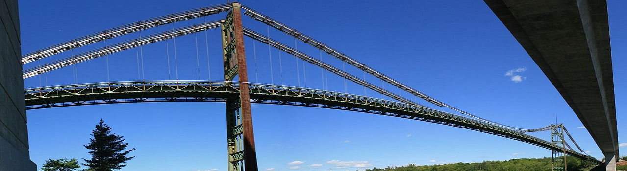
We perform services of collection, analysis, presentation and delivery of the geospatial information through Laser Scanners. We are able to detect the details of a researched environment / scene, allowing a detailed reconstruction of the geometry of the different elements: from small objects to large infrastructures. After scanning the data, they are processed in high quality 3D models, which have the advantage of highlighting all the anomalies in the natural elements or in the infrastructures. This allows us to obtain accurate models of the actual situation of a building or facility, so that documentation or maintenance projects can be carried out based on their actual situation. In addition, they allow to compare the temporal evolution of an object, allowing to identify deformations, movements, etc.
Technological solution
The laser scanner is a system that measures the distance from the scanner to the surface of an object and its spatial position (X, Y, Z) in the form of a cloud at high speed (from several thousand to one million points per second) Of points. Using laser scanning we create precise 3D models, which represent the spatial relationship between the elements of the object. Laser scanning technology enables the generation of 3D models quickly (reverse engineering), as well as 2D documentation of industrial installations, engineering and architecture. Particularly useful for BIM (Building Information Modeling) projects widely used in architectural and engineering projects. It is an excellent alternative to traditional methods, which can not deal with object access problems, safety measurements or time and accuracy restrictions.

Laser scanning offers several ways to achieve cost savings when compared to
traditional methods:
-
Efficiency and Speed: Laser scanning is considerably faster and more efficient than traditional methods of surveying and data collection. It allows for rapid capture of detailed 3D information of an entire environment or structure in a fraction of the time it would take using conventional surveying techniques.
-
Reduced Labor Costs: The efficiency of laser scanning reduces the amount of manual labor required for data collection. A smaller team can cover a larger area in less time, leading to substantial savings in labor costs.
-
Accurate Data Capture: Laser scanning provides highly accurate and precise data, minimizing errors that could occur in traditional manual measurements. This accuracy reduces the likelihood of rework or corrections, ultimately saving both time and money.
-
Remote Scanning and Reduced Site Visits: Laser scanning allows for remote data collection, reducing the need for multiple site visits. This not only saves travel costs but also minimizes disruptions at the site and optimizes resource allocation.
-
Comprehensive Data in a Single Scan: Laser scanning captures a comprehensive dataset in a single scan, providing a detailed 3D model of the environment. This eliminates the need for multiple visits to gather additional data, resulting in significant time and cost savings.
-
Enhanced Visualization and Analysis: The 3D models generated from laser scanning provide a rich dataset for analysis and visualization. Engineers and architects can virtually assess the site, plan designs, and detect clashes or issues early in the project lifecycle, reducing potential rework and associated costs.
-
Streamlined Project Management: The detailed and accurate information obtained through laser scanning allows for improved project planning and management. It helps in better decision-making, minimizing costly errors, and ensuring the project stays within budget and on schedule.
-
Better Asset Management: For industries like facility management and infrastructure, laser scanning provides a comprehensive record of assets. This aids in efficient maintenance planning, reducing downtime and associated costs.
In summary, laser scanning optimizes the data acquisition process, providing highly accurate and detailed information swiftly, leading to reduced labor, fewer site visits, and enhanced decision-making, all of which contribute to significant cost savings compared to traditional methods.
Laser scanning is a process that transforms physical objects into precise digital models, enabling swift and accurate capture of shape and geometry. This approach yields a comprehensive digital representation of architecture, infrastructure, or heritage elements, suitable for reverse engineering, quality inspection, or various stages in the manufacturing cycle.
High-definition scanning services allow for the creation of new 3D models based on existing construction conditions, leading to thorough element documentation. The speed of response provided by laser scanning surpasses traditional methods significantly, offering abundant visual aids during the design phase. These aids prove invaluable for efficient project reviews and contribute to elevating the quality of service for the customer.
A prevailing misconception regarding laser scanning technology is that it is primarily an advanced tool for spatial data acquisition in topographic applications. While undeniably crucial, 3D laser scanning transcends this perception, presenting a multitude of opportunities for customers, project managers, architects, and engineers. It enables them to actively monitor, thoroughly evaluate, and deeply analyze physical data employing widely used modeling software like AutoCAD, Autodesk Revit, Graphisoft ArchiCAD, Navisworks, Solidworks, Tekla, Inventor, and more.
Beyond the efficiencies in time and cost compared to traditional methods, 3D laser scanning equips decision-makers with a transformative tool to comprehensively evaluate existing conditions, monitor construction progress, conduct thorough structural and cultural assessments, document built conditions, and effectively manage extensive asset portfolios. In essence, 3D laser scanning establishes a solid groundwork for significantly improving information management in projects and asset management programs on a broader scale.
The laser scanning process


